
Planning, Article 4 and boundary checks in Bristol
How high you can go, the streets where taking an old fence or wall down needs permission, which council you are actually in, and whose boundary it is in the first place. Settled before we price the work.
This is the part of a fencing job nobody quotes for and plenty get wrong. It costs nothing to check, so we do it first.
The national rule: 2 metres, or 1 metre by a road
Fences, walls and gates are permitted development up to 2 metres, or up to 1 metre where they border a highway used by vehicles or its footpath. Conservation areas, listed buildings and Article 4 Directions override this.
Source: Bristol City Council, check if you need planning permission.
Two things in that wording repay a second read. It says fences, walls and gates, so a garden wall and a gate carry the same limits as a fence panel. And the 1 metre limit turns on a boundary bordering a highway used by vehicles or its footpath, which catches a front garden on a through road while the back garden stays at 2 metres.
Bristol has 33 conservation areas
They cover roughly 30 percent of the city, so this check is a coin toss on many streets rather than a formality. Clifton and Hotwells, Bedminster and Gloucester Road are the ones we meet most, plus Westbury-on-Trym below.
Inside one the height limits still apply, and the council also takes an interest in how the boundary looks from the street: a material nobody would query on a 1970s estate can attract questions on a Georgian frontage.
The Article 4 Directions, by name and date
An Article 4 Direction removes permitted development rights in a defined area, so work that normally needs no permission suddenly does. Bristol has several that name boundary treatments.
Henleaze, from 22 April 2021. Permission needed to demolish a gate, fence, wall or any other means of enclosure.
Cotham and Redland conservation area, from 4 November 2012. Permission needed to demolish a front garden wall, fence or gate, and to form hard standings.
Grove Wood, Blackberry Hill, from 9 November 2009. Alterations, constructions and extensions to walls, gates, fences and means of enclosure. Anchored to the Blackberry Hill Hospital site on Manor Road in Fishponds, a small area and an easy one to be caught by.
Henbury, 1971, and land at Sherrin Way, 26 July 1982. Both cover the erection of boundary treatments.
Source: Bristol City Council, restrictions on permitted development, Article 4 Directions.
Read the first two again, because they run the opposite way to everyone's assumption: the permission is needed to demolish. Taking out a tired front garden wall to widen an entrance, or dropping an old fence before the new one arrives, is the exact act they name, and by the time anyone notices, the wall is in a skip. We check the address against the council's mapping, not the postcode: Henleaze and Westbury-on-Trym are both BS9 and the rules differ.
Westbury-on-Trym and its limestone rubble walls
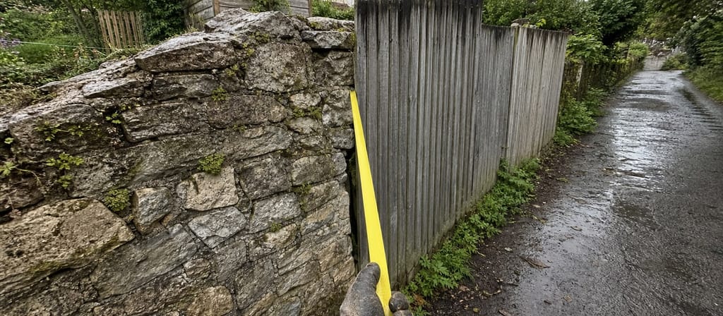
Westbury-on-Trym is Conservation Area No.2, designated in 1972 and one of the first the council drew. It carries no Article 4 Direction of its own, which sounds like good news until you read the council's conservation plan for the village. Principle P35 specifically protects the many limestone rubble walls there, and flags their erosion and their removal for parking as a problem.
So if your boundary is one of those walls, do not start taking it out to widen an entrance without asking. Where a wall is bulging or losing its cap, the honest answer is usually a stone repair rather than any work of ours.
Kingswood, Filton and Keynsham are not Bristol City Council
Everything above applies inside the Bristol City Council boundary and nowhere else. That is how homeowners get confident wrong advice.
- Kingswood and Filton are South Gloucestershire Council. Bristol's Article 4 Directions and conservation area rules have no force there.
- Keynsham is Bath and North East Somerset. A third planning regime again, with its own designations.
- South Gloucestershire runs its own set of around 30 conservation areas, and neither Kingswood nor Filton is one of them, so standard permitted development applies there: up to 2 metres, and up to 1 metre where the boundary borders a highway used by vehicles or its footpath.
If you are in Kingswood, none of the Henleaze or Cotham and Redland notes apply to you. The Kingswood page says so plainly, and our service areas page lists every area with its council.
Whose fence is it? The deeds are the only reliable answer
Not the side the posts are on, not who painted it last, and not the old story about left as you look out of the back door. The deeds settle it, specifically the plan attached to them.
- A T mark sits on the boundary with its stem on the line and its crossbar pointing into one garden. That garden is the one responsible.
- An H mark, two T marks joined back to back across the line, means the boundary is shared.
- No mark at all is common on older plans. Where the plan is unmarked the deeds do not settle it, and no fencing firm can settle it for you either.
We ask for the plan before quoting a full boundary. Replacing half of a shared fence without agreeing it first turns a simple job into a dispute.
The good side is not a legal obligation. There is no legal requirement to face the smooth side of a fence towards your neighbour. It is a courtesy and a widespread convention, not a right anybody can insist on.
Source: published guidance from a UK household insurer on which side of the fence you own.
What we could not verify, said plainly
There is a Clifton Village Article 4 Direction from July 1974 covering external alterations. We will not tell you whether it catches your fence, because it is not written in the terms that spell out boundary treatments the way the later directions are. On a Clifton address we check the property with the council rather than claiming it applies or does not. A firm that answers that one confidently has not looked it up.
What we do before we price
- Check the address, not the postcode, against the council's conservation area and Article 4 mapping.
- Confirm which council you are in, especially on the South Gloucestershire edge.
- Measure the height against the limit for that boundary, which can differ on two sides of one garden.
- Read the deeds plan with you, and photograph a conservation area boundary before it comes down.
None of it is chargeable. The whole rule set is written up as a guide: fence height and planning permission in Bristol.
Not sure where you stand?
Send the address and what you are planning. We check the council position and come back in writing, at no charge and with no obligation.